Thursday, 26 December 2013

Seven Sisters...........the Fifth Sister


The Fifth Sister - Manipur

*     Believe me, If you are a risk taker and believe in real adventure, then Manipur is the right place for you. Forget the insurgency for a while and see the place yourself. Its history and beauty can't be described in words. However, I would try to make an attempt to................. 


*   Manipur, through the ages, has been known as Meitrabak, Kangleipak or Meeteileipak, as well as by other names. Neighboring cultures had differing names for Manipur and its people. The Shan called the area Cassay, the Burmese Kathe, and the Assamese Meklee. In the first treaty between the British East India Company and King Bhagyachandra signed in 1762, the kingdom was recorded as Meckley. King Bhagyachandra and his successors issued coins engraved with "Manipureshwar." Later on, it became Manipur.

*       The Loktak Lake, the largest freshwater lake in northeast India, is also called the only Floating lake in the world due to the floating phumdis (heterogeneous mass of vegetation, soil, and organic matters at various stages of decomposition). This ancient lake plays an important role in the economy of Manipur and is a source of livelihood for the rural fisherman who live in the surrounding areas and on phumdis. 


*     The Dzükou Valley, partly lies in Manipur and partly in Nagaland. This valley is well known for its natural beauty, seasonal flowers and the overall flora and fauna. The rare Dzükou lily is found only in this valley.


*    This is the tip of iceberg. The state has so much to offer to travellers and explorers. So come and explore the place and I'm sure you won't be disappointed.

Monday, 16 December 2013

Seven Sisters..........the Fourth Sister


The Fourth Sister-- Nagaland


*     Nagaland is largely a mountainous state. The Hills rise from the Brahmaputra Valley in Assam to about 2,000 feet and rise further to the southeast, as high as 6,000 feet. Mount Saramati, 12,601 feet is the highest peak, where the Naga Hills merge with the Patkai Range in Burma. Nagaland is rich in flora and fauna. It has largely a monsoon climate with high humidity . By and large, the state enjoys a salubrious climate. Summer is the shortest season and lasts for only a few months.

*      The Dzukou Valley, tucked away at 2,438 m above sea level and behind the Japfu Range, is Nagaland's very own Valley of Flowers.  Dzükou derives its meaning from the Angami/Mao word which means "Cold Water" referring to the ice cold stream that flows through the valley.  During the monsoon, the valley turns into a riot of colours. Untainted by tourists, it has retained its pristine beauty. It's one of the three most beautiful valleys in India.


*     Nagaland is the land of  16 tribes, Angami, Ao, Chakhesang, Chang, Dimasa Kachari, Khiamniungan, Konyak, Lotha, Phom, Pochury, Rengma, Sangtam, Sumi, Yimchunger, Kuki and Zeliang. Every tribe has its own unique dialect but do not have any script of their own. Tribal traditions and loyalties play an important part in the life of Nagas. Weaving is a traditional art handed down through generations. Each tribe has its own unique designs and colour, producing shawl, shoulder bags, decorative spears, table mats, wood carvings, and bamboo works. Among many tribes the design of the shawl denotes the social status of the wearer.

*     Folk songs and dances are essential ingredients of the Naga culture. The oral tradition is kept alive through folk tales and songs. Naga folks songs are both romantic and historical, and these narrate the stories of famous ancestors and incidents. 


*     The Hornbill Festival named after the Hornbill, takes place between 1 and 7 December every year. It is held at Naga Heritage Village, Kisama 12 km from Kohima. All the tribes take part in this festival. The aim of the festival is to revive and protect the rich culture of Nagaland and display its extravaganza and traditions. The week long festival unites one and all in Nagaland.

*      The state has been the inspiration for several of my short stories ('Quest' is in the blog), though I'm yet to explore it fully. Hopefully someday I would and who knows the place might inspire me to pen down a novel........

Tuesday, 10 December 2013

Mandela...............the Great Unifier.


*    Nelson Mandela was arguably one of the greatest human being of this century. His efforts to unify a divided South Africa and make it into a prosperous African nation is his greatest achievement. 

*    Perhaps there was a lesson for each African nation to learn from his life of compassion, forgiveness and humility. Today the white folks in South Africa would mourn his death more than the blacks. 

*    Mandela's South Africa remains only ray of hope across the continent where countries from east to west and north to south are caught in ethnic strife, majority between the Muslims and the Christians, while the rest between various tribes. The leaders in those countries are hell bent on destroying their countries for their narrow political gains.

*     Perhaps, Mandela, after political retirement, should have spent more time  in other African countries and unified some of them. Because Mandela didn't belong to one nation. He belonged to whole African continent and the world.

*     Africa has lost him, not South Africa.

Friday, 6 December 2013

Seven Sisters.............the Third Sister


The Third Sister -- Meghalaya


*     Meghalaya, the abode of clouds, is one of the most beautiful places
       on planet. Its beauty during rains is seen to be believed.
       Cherrapunji,not long ago, the rainiest place on earth is called
       'Sohra' in local dialect. When British couldn't pronounce it, they
       called it Cherra and punji in Khasi means village. That's how
       erstwhile village of Sohra got name of Cherrapuji. The place so
       inspired me that wrote a short story by the same name. 

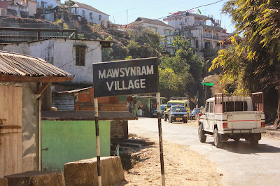
*     The rainiest place on planet, Mawsynram, is in Meghalaya. I have
       not been to Scotland but in Meghalaya there are moors, akin to
       those in Scotland. Perhaps, it's rightfully called "Scotland of the
       East".


*     The Khasis, part of the Hynniewtrep people and one of the earliest
       ethnic groups of  settlers belong to the Proto-Australoid
       Monkhmer race, believed to have migrated from their homeland in
       the Mekong Valley in Cambodia. The wave of migration from
       there over many centuries would have passed through the region
       of Indo-China and Burma, via the Patkoi range and settled down
       for some years in the North Cachar Hills of Assam before
       reaching its present destination. 

*     As per the Khasi tradition, in the prehistoric time, the humans
       dwelt in heavens together with divine beings. The human beings
       then belonged to Khadhynriew Trep Khadhynriew Skum (The
       sixteen Huts). When it was decided to populate earth, seven of
       these groups descended below. In the beginning existed a tree
       that served as a link between heaven and earth. The ancestors
       of the Khasis freely commuted between those two places by
       means of this golden ladder. But in due course of time they 
       began to sin and lost their original state of righteousness and
       thus the link with heaven got broken.   

*     The Khasi history is a mixture of myths, fables and folklores. They
       believe in one Supreme Being, the Creator whom they called as
       U Blei Nongthaw whose manifestation they see in the groves,
       forests, hillocks, peaks and rivers. Thus these places over which,
       the Khasis believe that myriads of spirits, good and bad, hovered,
       became as the places of worship. For heartrending folktale of
       Nohkalikai, visit the beautiful waterfalls and hear the tale from
       the guide.......


*     Discover the land and its wonderful folks yourself........


Sunday, 1 December 2013

Seven Sisters..............the Second Sister


                         ·                         
          The Second Sister.....Tripura


                Tripura in Sanskrit means three cities, corresponding exactly to the Greek
                Tripolis. Tripur was the 39th descendant of Druhyu, who belonged to the
                lineage of Yayati, a king of the Lunar Dynasty. However, a Kokborok
                etymology from tui (water) and pra (near) seems more appropriate as the 
                boundaries of Tripura extended to the Bay of Bengal when the kings of
                the Twipra Kingdom held sway from the Garo Hills of Meghalaya to the
                Arakan, the present Rakhine State of Burma.
                
·         In Tripura, upper Paleolithic tools made of fossil wood have been found in the Haora and Khowai valleys. The Indian epic the Mahabharata, the Puranas and the edicts of Ashoka – all mention Tripura. The region was under the rule of the Twipra Kingdom for centuries. The Rajmala, a chronicle of Tripuri kings first written in the 15th century, provides a list of 179 kings, from antiquity up to Krishna Manikya (1830–1850). The sculptures at the archaeological sites Unakoti, Pilak and Devtamura provide historical evidence of artistic fusion between organised and tribal religions.  


       There were several Muslim invasions of the region from the 13th century onward, culminating in Mughal dominance of the plains of the kingdom in 1733. Tripura became a princely state during the British rule. Following the independence in 1947, the Maharani of Tripura signed the Tripura Merger Agreement on 9 September 1949, as a result of which Tripura became a Part C state of India. It became a Union Territory, without a legislature in November 1956. The road distance between Kolkata and Agartala before partition was less than 350 km and increased to 1,700 km after partition.

·        Tripura along with Manipur and Meghalaya became a state on 21 January 1972. Since partition of India, many Hindu Bengalis migrated to Tripura as refugees from East Pakistan. Before independence, most of the population was indigenous. Ethnic strife between the tribes and the predominantly immigrant Bengali community led to scattered violence, and an insurgency spanning decades.

·        The dominant ethnic groups are Bengali, Manipuri, Tripuris, Jamatia, Reang, Noatia, Koloi, Murasing, Chakma, Halam, Garo, Kuki, Mizo, Mogh, Munda, Oraon, Santhal, and Uchoi. Bengali people represent the largest ethno-linguist community of the state. Bengali culture, as a result, is the main non-indigenous culture. The Tripuri kings were great patrons of Bengali culture, especially literature; Bengali language was the language of the court. Elements of Bengali culture, such as Bengali literature, Bengali music, and Bengali cuisine are widespread, particularly in the urban areas of the state.


·        Tripura lies in a geographically disadvantageous location in India, as only one major highway, the National Highway 44, connects it with the rest of the country. Five mountain ranges—Boromura, Atharamura, Longtharai, Shakhan and Jampui Hills—run north to south, with intervening valleys; Agartala, the capital, is located on a plain to the west. The state has a tropical savanna climate, and receives seasonal heavy rains from the south west monsoon. Forests cover more than half of the area, in which bamboo and cane tracts are common.     

          
Related Posts with Thumbnails